
What Developers Should Review Before Combining Multiple Urban Lots Into One Project Site
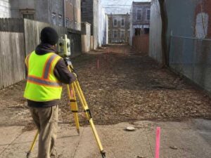
Two narrow lots can look like one clean building site on a map. On the ground, they rarely line up neatly. Older blocks are full of odd parcels, split ownership and lines that were drawn a century ago. Before you merge lots into a single project site, a subdivision survey tells you what you’re really working with. It confirms the boundaries, the conditions and the limits that shape your plan. This article walks through what to check before you combine, so the plan you draw is the plan you can build.
What Is a Subdivision Survey and Why Do Developers Need One Before Combining Lots?
A subdivision survey helps developers define, divide, combine or reorganize land parcels. It documents boundaries, existing conditions and the property information needed for planning. When you combine lots, this survey is the record that makes the change official and accurate.
Urban development runs on good parcel data. A subdivision survey gives the city, your engineer and your title team one shared source of truth. It shows how the separate lots fit together and where the new single boundary sits. Older Baltimore neighborhoods make this work harder. Small parcels, unusual shapes and thin historical records are common, so the paper rarely tells the whole story.
How a Subdivision Survey Helps Confirm Existing Urban Lot Conditions
Recorded documents describe a parcel as it was filed, sometimes decades back. What stands there now can be different. A subdivision survey checks the ground against the record, so you plan from reality.
Here’s what it confirms on urban lots:
- Actual parcel dimensions, which may differ from the recorded ones
- Existing improvements like paving, walls and utilities
- Structures that cross a boundary line
- Access areas and shared passages
- Physical site conditions that affect layout
In older areas, gaps between record and reality show up often. A wall may sit inches over a line. A shared alley may not match any deed. Catching these before design saves you from drawing a plan the site can’t hold.
What Developers Should Review Before Combining Multiple Parcels Into One Development Site
Before you merge parcels, review the items that can change the whole plan. Skip one and you risk a redesign later. This is the short list worth confirming first.
- Property boundaries and how the lines actually meet
- Ownership information for every parcel in the deal
- Easements that give others rights across the land
- Rights-of-way for roads, alleys or utilities
- Access limitations that affect entry and exit
- Existing improvements that may need to stay or go
Each of these feeds a subdivision decision. An easement down the middle can block where you place a building. A right-of-way can shrink your usable area. Confirm ownership on all parcels early, because one unclear title can stall the entire combination.
How Subdivision Surveys Support Baltimore Infill and Redevelopment Projects
Infill work depends on precise parcel data. Baltimore has many small, empty or underused lots sitting between existing buildings. A subdivision survey lets developers combine those lots into a site big enough to build something useful.
The survey supports a range of urban projects. Infill housing needs clean lines to fit new units on tight ground. Mixed-use redevelopment needs a clear site plan before approvals. Commercial projects need to know exactly what they’re combining. Vacant parcel improvements often start with confirming what the parcel even contains.
Baltimore’s narrow city lots are a common case. Combining several into one buildable site only works when the survey confirms they truly connect. On older blocks, planning around existing structures takes accurate positions, not guesses. Good survey data keeps the project moving instead of stalling at plan review.
Why Developers Should Complete a Subdivision Survey Before Finalizing Site Plans
Order the subdivision survey before the site plan is locked. Design built on wrong parcel data leads to redesign, and redesign burns time and money. Real numbers up front keep the first plan close to the final one.
Accurate survey data also improves how your team works together. Architects and engineers draw from the same confirmed base. The city sees clean, consistent parcel information. Site limits show up on paper before they show up on a bill. Approvals tend to move smoother when the parcel record is clear and current.
One honest note: a subdivision survey reflects conditions on the day it’s done, and it works best when a licensed surveyor handles the specific parcels and local filing rules. It supports your plan, but it doesn’t replace title review or zoning checks. Treat it as one strong piece of your due diligence.
If you’re planning a Baltimore project that combines lots, talk to a licensed surveyor before you buy or modify any parcel. Ask what a subdivision survey would show for your specific site. That conversation can save you a costly redesign down the line.
Frequently Asked Questions
What is a subdivision survey used for?
A subdivision survey is used to define, divide, combine, or reorganize land parcels. It documents property boundaries, existing conditions, and other details needed for development planning. Developers rely on subdivision surveys when changing how parcels are arranged because they provide an accurate foundation for the project.
What does a subdivision survey show?
A subdivision survey shows the actual dimensions of parcels and how property lines connect on the ground. It also identifies existing improvements, structures that cross boundaries, access areas, and other site conditions. For older properties, it can reveal differences between current conditions and recorded documents.
What should developers check before combining multiple lots?
Developers should review property boundaries, ownership records, easements, rights-of-way, access limitations, and existing improvements before combining lots. Confirming that parcels connect as expected helps prevent design changes, title issues, and delays during the development process.
Why are subdivision surveys important for urban development?
Subdivision surveys provide accurate parcel information for urban projects involving infill housing, mixed-use development, and redevelopment. Older city lots often have complex histories, irregular boundaries, or outdated records, making reliable survey data essential for smoother planning and approvals.
When should a developer order a subdivision survey?
A developer should order a subdivision survey early, before finalizing site plans or beginning detailed design work. Starting with accurate parcel information helps prevent costly redesigns and allows architects, engineers, and planners to work from reliable site conditions.
For a free land surveying quote, call us at (410) 883-5300 or send us a message by going here.
Posted in land surveying, land surveyor | Tagged Land Surveying
