
Vacant Lot Between Two Buildings? A Property Survey Can Reconstruct What Belongs Where
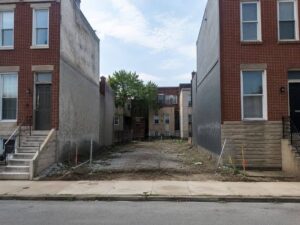
Empty land between buildings looks simple. No building stands there. The ground is clear. That does not mean the boundaries are easy to find. The lot may have been vacant for decades. Old markers disappeared. Fences or walls may have been built in the wrong place. A property survey recovers the true boundaries from records and site evidence. It tells you exactly what belongs where.
Empty Land Can Have a Complicated Record History
Vacant does not mean simple. The lot may have changed owners many times. Deeds may reference corners that no longer exist. Old plats may show different sizes or shapes. Parts may have been sold off or merged long ago. No one updated the description. When you try to find the lot today, you find conflicting measurements and missing references.
A surveyor studies every available record. They compare deeds, plats, and previous surveys. They trace how the lot was described over time. They identify which measurements still make sense and which appear wrong. They then search the site for physical evidence. This work turns conflicting papers into a clear picture of the lot as it legally exists.
Adjacent Buildings Provide Context but Not the Final Boundary
Neighboring buildings often sit close to the lot lines. Walls may look like they mark the boundary. They do not. Builders may have set walls back a few inches. Or they may have built slightly over the line years ago. Walls show where people chose to build. They do not prove where the legal line runs.
The surveyor measures the buildings but does not treat them as boundaries. They use independent evidence such as recorded distances, remaining monuments, and agreed lines from older surveys. They determine where the true boundary sits regardless of where neighbors built. The result may show walls partly on your lot or partly on theirs. That answer guides every decision about what you build.
Search for Evidence Left Behind by Earlier Development
Even vacant lots hold clues. Old foundations, pavement edges, fence posts, or utility lines may remain underground or buried. Surveyors look for these physical clues. They compare what they find against recorded descriptions. A remaining stone corner or iron pin often settles a measurement dispute.
Evidence the surveyor may locate includes:
- Remaining monument pins or stone corners set when the area was first laid out
- Buried foundation edges or pavement borders from former use
- Fence post lines or wall bases that once marked a property division
- Utility lines or markers installed when the lot was last active
These clues help confirm which measurements match actual conditions. They support the surveyor’s opinion of where boundaries run. They also show whether the lot was used differently in the past. That history may affect what you can do today.
Confirm Access Before Designing the New Use
A lot between buildings needs a way to reach the street. That access may be a front entrance, an alley behind, or a shared driveway along one side. Visible access does not always mean legal access. The route may sit partly on a neighbor’s land. It may have no recorded easement. Or it may be private and permission can be withdrawn.
The survey shows the lot’s connection to public streets or alleys. It shows whether access lies entirely within the lot or depends on land owned by others. It also notes any recorded easements that support your right to use the route. If reliable access depends on an unwritten agreement, you learn that before you design or buy. You cannot build a successful project if customers or deliveries cannot legally reach the site.
Give the Redevelopment Team a Verified Parcel Base
Architects and engineers need accurate boundaries to design safely. They need to know exactly how much space they have and where setbacks apply. If they design from estimates, they may place walls or foundations across property lines. That means expensive changes or legal disputes later.
The survey provides verified boundaries and dimensions. Every corner is measured and mapped. Designers work from facts not guesses. They know exactly how close they may build to each line. They understand which areas belong to others and which rights apply. That verified base protects your design, your permit, and your investment. You start with certainty instead of hoping for the best.
For a free land surveying quote, call us at (410) 883-5300 or send us a message by going here.
Posted in Property survey
