
Land Surveying for Townhome Development in Baltimore
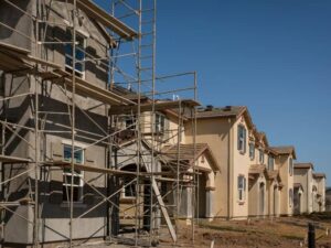
A row of townhomes leaves very little room for error. Each unit shares walls, a roofline, and often a driveway or alley with the one beside it. If one lot line is wrong, the mistake can repeat down the whole row.
Land surveying keeps a townhome project tied to real, measured ground from the first site visit to the final plat. In Baltimore, that work often happens on tight infill parcels, former industrial lots, or land beside older rowhouse blocks. The short version is simple. Bring a surveyor in before design starts, and keep them involved until the last unit is documented.
Establishing the Townhome Development Site Before Design
The first step is usually a boundary and topographic survey of the whole parcel. It shows where the property lines are, what sits on the land, and how the ground slopes. Designers need this base map before they draw a single unit.
The research side can take real effort. Many parcels have deeds that go back generations, and some describe lines using old street widths, alleys that were never opened, or buildings that are long gone. A surveyor compares deeds, recorded plats, and physical evidence like iron pins and old walls to settle where the lines actually fall.
Before design starts, ask your surveyor to confirm:
- Easements, rights-of-way, and any paper alleys that cross or border the site
- Existing utilities, curbs, trees, and structures
- Spot elevations and contours across the full parcel
- Conflicts between the deed, the title commitment, and conditions on the ground
If a lender or title company is involved, they may also ask for an ALTA/NSPS survey. Requirements vary by lender, so confirm the scope early. That way one round of fieldwork can serve both the design team and the closing.
Planning Individual Lots and Shared Areas
Townhome projects usually split one parcel into many small lots plus common areas. Each unit often sits on its own lot, while parking, sidewalks, open space, and stormwater features are commonly held by a homeowners association. The surveyor turns that plan into precise lot lines, dimensions, and areas that can be recorded.
Lot Lines and Shared Walls
Lot lines between units often run through the center of the shared wall. That line has to match what the architect draws and what the builder frames. Small differences add up fast when a row has eight or ten units.
Easements for Shared Access and Utilities
Shared driveways , rear alleys, and utility runs usually cross several lots. Each one needs a clear easement so owners know who can use it and who maintains it. The surveyor shows these on the subdivision plat so buyers and title companies can see them later.
Local subdivision and zoning rules shape lot size, frontage, and setbacks. Those rules differ between Baltimore City and Baltimore County, and they can change over time. Your engineer and surveyor should confirm current standards with the right office before the plat is finalized.
Coordinating Townhome Layout With Site Grades and Utilities
Townhomes in a row need grades that step smoothly from one unit to the next. The topographic survey shows where the land rises and falls, so the engineer can set floor elevations, driveway slopes, and drainage paths that work together. Without good elevation data, one unit can end up draining toward its neighbor.
Stormwater is a big part of this in Maryland. Projects often need to meet state and local stormwater design standards, which can affect how much space goes to bioretention areas, ponds, or other practices. Those features take up land, so their size and location can reshape the lot layout.
Utilities matter just as much. Older parts can have water, sewer, and storm lines that are aging or poorly mapped. Ask the surveyor to locate visible structures like manholes and inlets and record their depths where they can be reached. Pair that with utility records and a private locate so the design rests on the best data available.
Carrying the Approved Layout Into Construction
Once plans are approved, construction staking moves the design from paper to the site. The surveyor sets stakes and marks that show crews where to dig, pour, and build. On a townhome job, that includes building corners, foundation lines, curbs, utilities, and finished grade points.
Accuracy matters most at the shared walls. If one foundation is set a few inches off, the next unit either shifts or gets squeezed. Many builders ask for a foundation location check after footings or walls are poured, so problems get caught before framing.
Keep the surveyor in the loop on plan changes. A revised unit width or a moved inlet should reach the field crew before stakes go in. Clear communication between the builder, the engineer, and the survey team saves costly rework.
Documenting the Completed Townhome Development
When construction wraps up, the surveyor documents what was actually built. An as-built survey shows final building locations, grades, utilities, and stormwater features compared with the approved plans. Local agencies may require it before releasing bonds or accepting public improvements, though the rules vary by jurisdiction.
Individual lot surveys may also be needed as units sell. Buyers, lenders, and title companies often want to see that each home sits inside its lot and clear of easements. Clean final records make those closings go more smoothly.
Store the final plat, as-built drawings, and monument records with the HOA documents. Future owners will need them for fences, additions, and questions about shared areas. Good records now prevent confusion for years.
Frequently Asked Questions
What type of survey do I need before designing a townhome project?
Most projects start with a boundary and topographic survey of the whole parcel. The boundary work confirms property lines and easements, while the topographic work maps elevations and site features. Some lenders or title companies also ask for an ALTA/NSPS survey. Talk with your surveyor early so one scope can cover as many of these needs as possible.
How long does land surveying take for a townhome development?
Timing depends on parcel size, record research, and site conditions. A small infill site may take a few weeks for the first boundary and topographic survey. Staking and as-built work happen in phases as construction moves forward. Schedule the first survey as soon as you control the site so design isn’t delayed.
Who owns the common areas in a townhome project?
Common areas are often owned by a homeowners association, but it depends on how the project is set up. The surveyor shows these areas on the recorded plat with clear lines and labels. Legal ownership comes from the deeds and HOA documents. An attorney should confirm how ownership and maintenance are assigned.
For a free land surveying quote, call us at (410) 883-5300 or send us a message by going here.
Posted in land surveying, land surveyor | Tagged land surveying
