
How LiDAR Mapping Guides a Wooded Homesite Plan
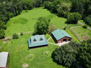
A wooded lot looks peaceful until you try to plan a house on it. Trees block sightlines. Slopes hide under leaf litter. What looks flat near the road might drop off sharply just past the tree line. This is where LiDAR mapping earns its keep. It shows the ground shape hiding under all that cover, and it gives homeowners and builders something real to plan around instead of a guess.
Wooded homesites carry more uncertainty than open lots. LiDAR mapping cuts through a good chunk of that uncertainty before anyone picks up a shovel or a chainsaw.
Reveal the Ground Shape Beneath a Wooded Homesite
LiDAR works by sending out laser pulses from a plane or drone and measuring how long they take to bounce back. Some of those pulses slip through small gaps in the tree canopy and hit the actual ground. Enough of them get through to build a detailed picture of the terrain, even with trees standing in the way.
This matters a lot on wooded land. Standing in a forest, it’s hard to tell if the ground slopes gently or drops off into a ravine twenty feet away. Vegetation hides grade changes that would be obvious on a cleared lot. A LiDAR-based terrain model strips away the guesswork and shows the slopes, dips, and flat spots as they really are.
For anyone planning a home on wooded land, this is the starting point. Everything else, from house placement to driveway routing, depends on knowing what the ground actually looks like.
Compare Potential House Locations Before Finalizing the Homesite
Once the terrain data is in hand, the next step is comparing spots across the property. A wooded parcel rarely has just one buildable area. There might be three or four spots that could work, each with different elevation, slope, and drainage characteristics.
LiDAR terrain models let planners look at these areas side by side without walking the whole property multiple times. A gentle rise near the center of the lot might sit higher than a spot closer to the road, which could matter for drainage or for the view from inside the house. A flatter section might need less grading, which can save money during construction.
This comparison is about the shape of the land itself, not about property lines or legal boundaries. Those are separate questions handled through different tools and separate documents.
Use LiDAR Mapping to Evaluate Driveway Approaches Through the Trees
Getting from the road to the house is its own planning challenge on a wooded lot. A straight line from the road to the homesite might look simple on a basic map, but it could run straight into a steep grade or a low spot that floods after rain.
Terrain models built from LiDAR data show where the land rises and falls between the road and the proposed house site. This helps identify natural breaks in the terrain where a driveway could curve around a slope instead of cutting straight through it. A route that follows the land’s natural contours often needs less excavation and holds up better over time than one forced through a steep section.
Planning the driveway path before clearing begins also means fewer surprises once equipment shows up on site.
Identify Where Selective Clearing May Be Needed
Not every tree on a wooded lot needs to come down. LiDAR data can separate the terrain readings from the vegetation readings, which shows where tree cover actually sits in relation to the planned house, driveway, and other usable areas.
This distinction helps project teams figure out exactly which trees stand in the way of construction and which ones can stay. A homesite plan built this way avoids clearing more land than necessary. It also helps identify where dense vegetation overlaps with a planned building footprint, so that information can factor into the layout before construction starts rather than after trees are already down.
Keeping this focused on the immediate planning area, rather than the whole property’s tree cover, keeps the process efficient and the results useful.
Turn LiDAR Terrain Data Into a More Informed Homesite Concept
All this terrain information comes together during early site planning. Contour lines, slope data, and vegetation patterns from LiDAR can be layered together so the house location, driveway path, and surrounding grading all get considered as one connected plan rather than separate decisions made in isolation.
This approach tends to produce a more realistic homesite concept. Builders and homeowners can see how the pieces fit together before committing to a design, which reduces the odds of running into grading problems or access issues mid-project.
One thing worth being clear about: LiDAR data shows terrain and vegetation. It does not establish legal property boundaries. A terrain model and a boundary survey answer different questions, and homesite planning benefits from having both.
For a free land surveying quote, call us at (410) 883-5300 or send us a message by going here.
Posted in Lidar Mapping | Tagged Lidar Mapping
