
Baltimore Land Surveyor for Transit-Oriented Development
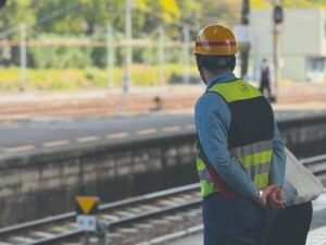
Transit-oriented development, often called TOD, puts homes, shops, and offices within an easy walk of a train station or bus stop. These projects can bring new life to older blocks. They also come with some of the hardest survey work in any city. Sites are often made up of odd-shaped lots, shared walls, public land, and transit property all packed close together.
A land surveyor helps you sort all of that out before design gets locked in. The survey shows who owns what, where people can walk, and how the ground rises and falls. Start the survey early, and your team will spend less time fixing plans later.
Survey Existing Conditions Around Transit-Oriented Development Sites
An existing conditions survey shows what’s on the site and around it today. A land surveyor measures buildings, sidewalks, curbs, driveways, walls, fences, trees, and parking areas. They also mark things you can see above ground, like manholes, utility poles, signal boxes, and bus shelters. This drawing becomes the base map for your whole design team.
Sites near transit are often crowded. You may have rail lines, platforms, bus lanes, bike racks, and busy crosswalks right next to your property line. Each one can affect where buildings, entrances, and loading areas can go. Missing even one feature can lead to a redesign once plans reach review.
Buried utilities need their own step. A survey shows what’s visible or on record, so underground lines still need to be marked. Call 811 before any digging, and ask your surveyor whether utility locating should be part of the scope.
Map Property Boundaries Across Complex Urban Parcels
A boundary survey shows where each property line is and how it fits with the lots around it. Many TOD projects combine several parcels into one site. Those parcels may have been split, sold, and rebuilt many times over the years. Their records don’t always line up neatly.
The land surveyor reads deeds, plats, and older public records for each lot. Then they compare that paper trail with what’s found on the ground. Gaps and overlaps between old deeds are common in older city blocks. So are buildings that sit right on the line or cross it by a few inches.
Watch for Gaps, Overlaps, and Encroachments
An encroachment is when something built crosses onto land you don’t own. It could be a wall, a stair, or part of a neighbor’s building. A gap is a thin strip of land that no deed seems to cover. Finding these issues early gives your lawyer and title company time to fix them before closing or permits get delayed.
Lenders on larger projects often ask for an ALTA/NSPS survey. This type of survey follows a national standard and covers boundaries, easements, and other title items. Requirements vary by lender, title company, and project scope, so confirm what’s needed before you order.
Document Transit Access, Rights-of-Way, and Site Connections
A right-of-way is land set aside for public use, like streets, sidewalks, or rail lines. Transit sites often sit next to several kinds of right-of-way at once. The land surveyor shows where these areas start and stop in relation to your property. That tells your team where private work ends and public work begins.
Easements matter here too. An easement gives someone else the right to use part of your land for a set reason. Transit agencies, utility companies, and neighbors may hold easements for access, drainage, or equipment. These rights can limit where you build or dig, so have your lawyer review any that affect the site.
The survey should also show how people get to the transit stop. Map the walking paths, crosswalks, curb ramps, and bus stops near the site. This helps planners design safe, direct links from your building to the station. Any work in public space usually needs its own approval, and rules vary by agency and project scope.
Capture Elevation Changes for Pedestrian and Site Design
Elevations are the measured heights of the ground and structures. A land surveyor records heights at sidewalks, curbs, doors, platforms, and nearby grades. This is often done as a topographic survey, which shows the shape of the land with contour lines. Even a flat-looking city block can have small rises and dips that matter.
These numbers shape how people move through the site. Walkways and ramps need gentle slopes so people with strollers, carts, or wheelchairs can use them. Your architect and engineer will confirm which accessibility rules apply. The surveyor’s job is to give them accurate heights to design from.
Drainage is the other big reason for good elevation data. Paved sites shed a lot of water during storms. Engineers use the survey to plan where water flows and where it should be collected. Good grades keep water off walkways and away from building entrances.
Coordinate Survey Data With Transit-Focused Development Plans
Survey data works best when every team uses the same base map. Architects, civil engineers, traffic planners, and contractors all need to work from matching numbers. The land surveyor sets control points, which are marked points with known locations and heights. Everyone ties their work back to those points.
Transit projects often go through several review steps. Plans may be checked by the city, the transit agency, and utility providers. Each group may ask for changes, and the survey may need small updates along the way. Keeping your surveyor involved makes those updates faster.
Construction staking comes later. The surveyor places stakes and marks on the ground so crews build in the right spot. On tight sites near active rail or bus lines, accurate layout helps avoid costly mistakes. Plan survey timing early, since design, permits, and construction can all stall without it.
Frequently Asked Questions
What type of survey do I need for a transit-oriented project?
Most projects start with a boundary survey and an existing conditions or topographic survey. Many also need an ALTA/NSPS survey for a loan or title insurance. The right mix depends on your lender, title company, and project scope. A surveyor can help you choose what fits your plans.
Why are urban parcels harder to survey?
City lots often have long, messy records that go back many years. Buildings may share walls or sit right on the property line. Old deeds can leave small gaps or overlaps between lots. The surveyor has to sort through all of it to find where the lines truly fall.
Does the survey show transit agency property?
A survey can show nearby rights-of-way and recorded easements when the right records are provided. The surveyor uses deeds, plats, and the title report to find them. Some transit land may need extra research through agency records. Ask about this early so it’s part of the scope.
How long does the survey take?
Timing depends on site size, record research, and how much detail your team needs. Busy transit areas can slow fieldwork because of traffic, crowds, and limited access. Ask for a time estimate when you request a price. Then build that time into your design and permit schedule.
Can old surveys be used for a new project?
It depends on how old the survey is and what it covers. Older surveys may miss new sidewalks, utilities, or changes to nearby transit features. Your surveyor can review the old work and tell you if an update will do the job. Combined parcels usually need fresh work that ties all the lots together.
For a free land surveying quote, call us at (410) 883-5300 or send us a message by going here.
Posted in land surveying, land surveyor | Tagged land surveyor
