
Baltimore ALTA Survey for Commercial Property With a Complicated Ownership History
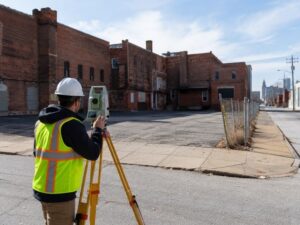
Many commercial sites in Baltimore grew over time. Owners bought neighboring lots and combined them. Deeds were written long ago with vague descriptions. Rights from the past may still affect the property today. An ALTA survey maps the current site and compares it against the full record history. It helps buyers understand exactly what they are buying and what old rights still apply.
Start With the Current Parcel, Then Work Back Through the Records
You need to know what the property looks like today before you can trace its history. The ALTA survey measures boundaries, buildings, pavements, and access routes. It shows what exists on the ground right now. Once the current layout is clear, you compare it against older deeds, plats, and surveys. You trace how boundaries changed over time.
This backward approach reveals gaps or conflicts. A deed from fifty years ago may describe corners that no longer match. An old easement may still appear in records even though no one remembers using it. Working from present conditions back to the past helps you spot exactly where descriptions diverge. That guides further research and questions for the seller. You learn whether the property you see today matches what the records describe.
Multiple Deeds May Describe Pieces of One Operating Site
Many commercial parcels were assembled from several smaller lots. Each lot has its own deed and description. Over time people treat the whole area as one property. Deeds get filed separately. They may use different coordinate systems or boundary descriptions. No one checks whether they all fit together correctly.
Title and survey teams need every deed and every plat. They compare legal descriptions across all documents. They confirm whether old boundaries still apply or whether they were merged or changed. They check whether easements or restrictions from one lot still affect the assembled site. If you rely only on the most recent deed, you miss rights and limits carried over from older parcels. The surveyor needs the complete record package to do the job correctly.
Occupied Areas Do Not Always Follow Historic Parcel Divisions
Buildings, parking lots, and driveways often ignore old property lines. A warehouse built across two lots. A parking lot paved over three original parcels. A driveway placed where an old line once ran. People use the land as one unit. But legal boundaries may still exist beneath the pavement.
The ALTA survey shows historic lot lines alongside current improvements. You learn whether a building sits entirely within one parcel or crosses into another. You see which part of the parking lot belongs to which original deed. These overlaps create title problems. They may need agreements or corrections before you can buy and insure the property. The survey reveals these issues early so title teams can solve them.
Compare Easements and Access Rights Across the Ownership Timeline
Easements and access rights often survive changes in ownership. A road easement written in 1950 may still apply today. A utility easement from 1980 may run across the property even though it is not mentioned in the newest deed. Rights do not disappear automatically just because the property changed hands.
The ALTA survey lists every recorded easement and maps its location. You compare them across the ownership history. You look for rights that were never formally released. You check whether new agreements replaced old ones. You also see whether easements match what actually exists on the ground. An easement may say one thing in records while the actual road sits somewhere else. These differences need resolution before closing.
Resolve Mapping Questions Before the Commercial Closing
Complex history takes time to untangle. Conflicting deeds or missing records cannot be fixed in a day. Order the survey early. Give the surveyor and title team enough time to study the full history. Ask questions when things do not match. Resolve easements, overlaps, and gaps before you commit to buy.
Rushing this work creates risk. You may close on a property that has unresolved boundary issues or hidden easements. Those problems become yours to solve later. When you address questions early, the seller has time to provide documents or correct records. Everyone moves forward with clear facts. That protects your investment and avoids surprises after closing.
Frequently Asked Questions
Can an ALTA survey cover commercial property assembled from older parcels?
Yes. It maps the combined site and also shows where historic lot lines run. It reveals overlaps or gaps created when lots were merged.
What if several deeds describe different portions of the same site?
The surveyor compares all descriptions and maps them together. Differences must be resolved through title work before the property can be clearly conveyed.
Does a change in ownership automatically remove old easements?
No. Easements stay in effect until formally released or expired by law. New owners take the property subject to existing recorded rights.
What historical documents should the buyer provide to the surveyor?
Share every deed, plat, easement agreement, and survey you can find. Include title reports and any agreements affecting boundaries or access.
Can unresolved parcel questions delay a commercial transaction?
Yes. Survey or title issues discovered late often push back closing. Order the survey early so problems get solved before deadlines.
For a free land surveying quote, call us at (410) 883-5300 or send us a message by going here.
Posted in ALTA Survey
