
A Licensed Land Surveyor for Your Retaining Wall Plan
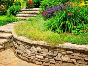
A retaining wall built two feet onto a neighbor’s lot is an expensive mistake to undo. So is a wall that traps water against a house or fails because the slope was misjudged. Hiring a licensed land surveyor before design starts gives you accurate lines, grades, and stakes so the wall goes in the right place the first time.
That’s especially true in Baltimore, where many lots are narrow, sloped, or packed tight against older rowhouses and alleys. Property lines on these lots can be hard to read from fences and old walls alone. This guide is written for homeowners first, with notes for contractors and engineers who build from the survey.
How a Licensed Land Surveyor Verifies Retaining Wall Placement
For a retaining wall, the surveyor’s job is to tie the planned wall to real locations on the ground. That means finding your property lines, measuring the slope, and marking where the wall should go. Each step builds on the one before it.
Contractors sometimes guess the wall location from an old fence or a neighbor’s word. That can go wrong fast on older city lots. A surveyor works from deeds, recorded plats, and markers in the field, which gives you a location you can rely on.
Checking Property Boundaries and Easements Before Wall Construction
Start with the boundary. A boundary survey shows where your lot lines are and marks the corners on the ground. It also shows how close existing walls, fences, sheds, and steps sit to those lines.
Next, check for easements. An easement is a legal right for someone else to use part of your property for a set purpose, such as utility lines, drainage, or shared access. A retaining wall built inside an easement may have to be removed if the easement holder needs to reach the area.
Ask your surveyor to show these items on the plan:
- Property corners and lot lines near the wall
- Recorded easements and rights-of-way
- Existing walls, fences, and structures close to the line
- Alleys or shared paths that touch the work area
Before digging, call 811 to reach Miss Utility, Maryland’s utility marking service. The surveyor can then pick up the marked utility lines and show them on the plan if needed.
Measuring Ground Elevations and Slopes for Retaining Wall Design
A retaining wall holds back soil where the ground changes height. To design it well, your engineer or wall designer needs to know how much the ground rises and falls. That information comes from a topographic survey.
A topographic survey measures ground heights across the site and shows them as contour lines and spot elevations. Contour lines connect points of the same height, so closely spaced lines mean a steep slope. The survey also records trees, walls, steps, and the edges of buildings near the work area.
This data shapes the whole design. It tells the designer how tall the wall must be, where it should step down, and how much soil needs to be cut or filled. Taller walls often need an engineer’s design and a permit, though the rules vary between Baltimore City and the surrounding counties.
Coordinating Survey Data With Drainage and Engineering Plans
Water is the biggest threat to a retaining wall. If rain can’t drain from behind the wall, pressure builds up and the wall can lean, crack, or fail. The survey gives designers the grades they need to plan where water will go.
Your engineer or designer uses the survey to plan drain pipes, gravel backfill, and outlets. They also check that water won’t be pushed onto a neighbor’s lot or toward your foundation. On sloped Baltimore lots, runoff from uphill properties can add more water than owners expect.
Share the survey files with everyone on the project. That usually includes your designer, engineer, and contractor. When all of them work from the same measurements, it’s easier to spot conflicts before the first block goes in.
Some projects also need a grading or stormwater review. Requirements depend on the wall height, the amount of disturbed ground, and your local permit office. Confirm these needs early so the survey covers what the reviewers will ask for.
Using Construction Staking to Position the Retaining Wall Accurately
Construction staking is the step that moves the design from paper to the ground. The surveyor places stakes, flags, or paint marks that show where the wall should start, end, and turn. Stakes can also show the planned top or bottom height of the wall.
This step protects your investment. A wall that drifts a few inches on a tight lot can cross a property line or block a drainage path. Staking gives the crew clear targets to build from.
Ask your contractor when they want stakes set. Stakes placed too early can get knocked over during clearing, so timing matters. Some projects also need a final check after the wall is built to confirm it matches the approved plan.
Frequently Asked Questions
Do I need a licensed land surveyor before building a retaining wall?
In many cases, yes. If the wall sits near a property line, an easement, or a steep slope, a survey helps you avoid costly mistakes. Some permit offices also ask for a site plan that shows the wall location, though needs vary by jurisdiction and wall height. Check with your local permit office early so you know what’s required.
Can a retaining wall be built directly along a property line?
Sometimes, but it depends on local rules and your neighbor. Some codes set minimum distances from property lines, and a wall on the line may need a written agreement with the adjoining owner. A wall that crosses the line by mistake can lead to disputes or removal. A licensed land surveyor can mark the line so you and your contractor know exactly where it is.
How does a topographic survey help with retaining wall planning?
A topographic survey measures the heights and slopes of the ground around the planned wall. Designers use it to set the wall height, plan steps, and figure out cut and fill. It also shows nearby features like trees, walls, and buildings. Without it, the wall design is based on guesses.
Can a land surveyor identify drainage and slope conditions near a proposed retaining wall?
Yes. A survey shows the slopes, low spots, and paths water is likely to follow across the site. It can also locate drains, inlets, and downspouts near the work area. Your engineer then uses that data to design the drainage system behind and around the wall.
When is construction staking needed for a retaining wall project?
Staking is most helpful when the wall sits close to a property line, an easement, or a building. It’s also useful for long or curved walls and walls with set height limits. The surveyor places the stakes after the design is final and before the crew starts digging. Talk with your contractor about timing so the stakes stay in place during work.
For a free land surveying quote, call us at (410) 883-5300 or send us a message by going here.
Posted in land surveying, land surveyor | Tagged land surveyor
